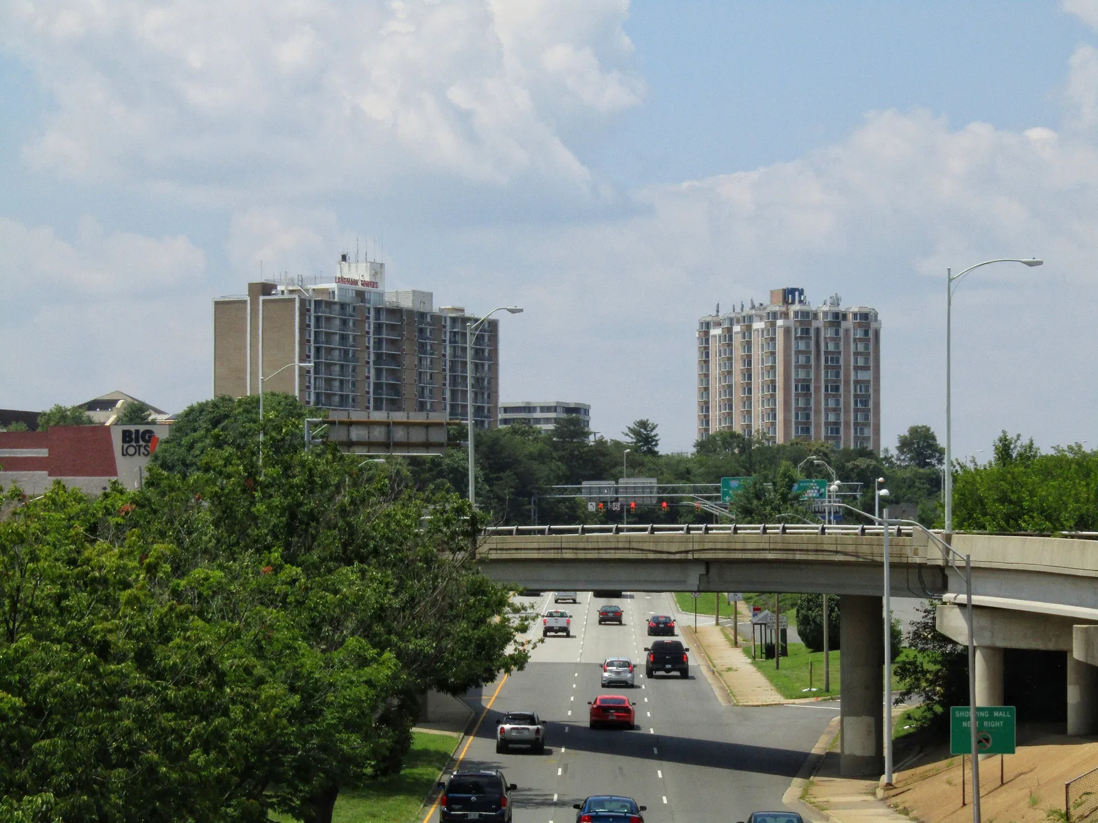
The 607-acre Landmark/Van Dorn plan area, home to the former Landmark Mall site, is in ZIP 22304. Typical 22304 value: $440,940.
Last checked Oct. 19, 2026. The boundary is the City of Alexandria’s Landmark/Van Dorn plan area, from its Small Area Plans map layer, the Landmark/Van Dorn Small Area Plan (PDF) and the Landmark/Van Dorn Corridor Plan (PDF). School zones come from Alexandria City Public Schools’ 2026-27 Attendance Zone Locator; ratings from the Virginia Department of Education’s School Quality Profiles; home values from the Zillow Home Value Index (Zillow Research); parks from the city’s parks map layer; associations from the city’s common ownership map; bus lines from DASH; place names, stores and road distances from OpenStreetMap (© OpenStreetMap contributors).
Landmark/Van Dorn is the 607-acre plan area at the city’s western end, around Duke Street, Van Dorn Street and the former Landmark Mall. All of it is in ZIP code 22304. The city’s corridor plan calls this part of Alexandria the West End and plans two mixed-use centers to serve the residential neighborhoods around them: the West End Town Center at the old mall site and an “urban village” at Pickett Place to the south.
What this means for you
- Zoned high school: Alexandria City High School (every city address)
- Typical home value, ZIP 22304: $440,940 in September 2026, according to Zillow
- Nearest interstate exit: I-395 Exit 3 (Duke Street), about 0.5 mile by road
- Zone questions: ACPS, 703-619-8000
Where it is
On the city’s map, I-395, Duke Street, Holmes Run and South Pickett Street form long stretches of the edge; Eisenhower West is next door to the south and Seminary Hill to the east. Duke Street, North and South Van Dorn Street, Edsall Road, Yoakum Parkway, Holmes Run Parkway, Stevenson Avenue and South Reynolds Street run through it.
The 2009 Landmark/Van Dorn Corridor Plan covers about 240 acres of shops, offices, homes and industrial land inside this area, in four districts: the West End Town Center at the mall site, Pickett Place, Van Dorn Metro and the existing residential areas. Chapter 10, added in 2019 and amended in 2021, replaced the earlier plan for the mall site. OpenStreetMap names that site WestEnd Alexandria.
Schools
Under the 2026-27 ACPS boundaries, the area is split among three elementary zones and two middle school zones:
| School | Share of area | Grades | Address | State report card |
|---|---|---|---|---|
| James K. Polk Elementary | about 40% | K-5 | 5000 Polk Ave. | School Quality Profile |
| Patrick Henry K-8 | about 30% (28% for grades 6-8) | K-8 | 4643 Taney Ave. | School Quality Profile |
| Samuel W. Tucker Elementary | about 29% | K-5 | 435 Ferdinand Day Drive | School Quality Profile |
| Francis C. Hammond Middle | about 72% | 6-8 | 4646 Seminary Road | School Quality Profile |
| Alexandria City High | all | 9-12 | Every city address | School Quality Profile |
All are Fully Accredited. In the state’s latest framework ratings, Polk (84.73), Patrick Henry (83.50), Tucker (83.57) and Alexandria City High (81.16) are Approaching Expectations, and Hammond (79.27) Needs Intensive Support. Tucker runs a modified school calendar, according to our schools guide. Check one address in the Attendance Zone Locator.
Home values
Zillow’s Home Value Index for ZIP 22304 was $440,940 in September 2026, down 0.9% from $444,919 in September 2025. The citywide figure was $662,843, up 1.0%. ZIP 22304 also covers Seminary Hill and Eisenhower West, so it is a broad guide to this area. The index is a modeled typical value for mid-priced homes, not a sale price. See our home prices guide.
Parks and trails
- Holmes Run Park and All Veterans Park, along Holmes Run Parkway
- Duke Street Dog Park, in the 5000 block of Duke Street
- Stevenson Park, 300 Stultz Road
- South Reynolds Park, 270 S. Reynolds St., a natural area
- The grounds of the Beatley Central Library, 5005 Duke St.
More in our parks and trails guide and walking and biking trails guide.
Getting around
Distances are measured on the road network from the middle of the plan area (OSRM routing on OpenStreetMap data); they are distances, not drive times.
| To | Distance |
|---|---|
| I-395 Exit 3 (Duke Street) | about 0.5 mile |
| Capital Beltway Exit 173 (Van Dorn Street) | about 1.5 miles |
| City Hall, 301 King St. | about 5.3 miles |
| Reagan National Airport | about 7.2 miles |
The nearest Metrorail station is Van Dorn Street, about half a mile south of the plan area. Fare-free DASH buses, according to DASH’s schedules:
- Line 30: Van Dorn Metro, Whiting Street and Duke Street to King Street and Braddock Road Metro
- Line 32: Landmark, Van Dorn Metro and Eisenhower Valley to King Street Metro
- Line 35: Van Dorn Metro, Yoakum Parkway and Beauregard Street to Pentagon Metro
See our getting around guide.
Homeowners and civic associations
The city’s common ownership map lists 22 condominium associations and two homeowners associations in the plan area. The civic association on the map is the Hillwood Civic Association. The city says associations last updated their own entries in 2015.
Groceries and everyday stores
- Safeway, 299 S. Van Dorn St., and CVS Pharmacy, 259 S. Van Dorn St.
- CVS Pharmacy, on North Pickett Street
- Harris Teeter, 4641 Duke St., with a pharmacy, and Aldi, 4580 Duke St., just east
How to check an address
Look up the parcel on the city’s real estate search; some “Alexandria” addresses west of here are in Fairfax County. Then check the school on the Attendance Zone Locator. Our property tax guide has the city rate, and our neighborhoods guide maps every plan area in the city.
Frequently asked questions
What school is the Landmark area of Alexandria zoned for?
It is split. Under the 2026-27 ACPS boundaries, about 40% of the Landmark/Van Dorn plan area is zoned for James K. Polk Elementary, 30% for Patrick Henry K-8 and 29% for Samuel W. Tucker Elementary. For middle school, 72% is zoned for Francis C. Hammond and 28% for Patrick Henry.
What ZIP code is Landmark in Alexandria?
The city’s Landmark/Van Dorn plan area is all in ZIP code 22304.
What is happening at the old Landmark Mall site?
The city’s Landmark/Van Dorn Corridor Plan, amended in 2019 and 2021, replaced its earlier plans for the mall site with a new chapter for a mixed-use district. OpenStreetMap now names the site WestEnd Alexandria.
What is the nearest Metro station to Landmark?
Van Dorn Street station, on the Blue Line, about half a mile south of the plan area. DASH Lines 30, 32 and 35 connect the area to it.
Have your say