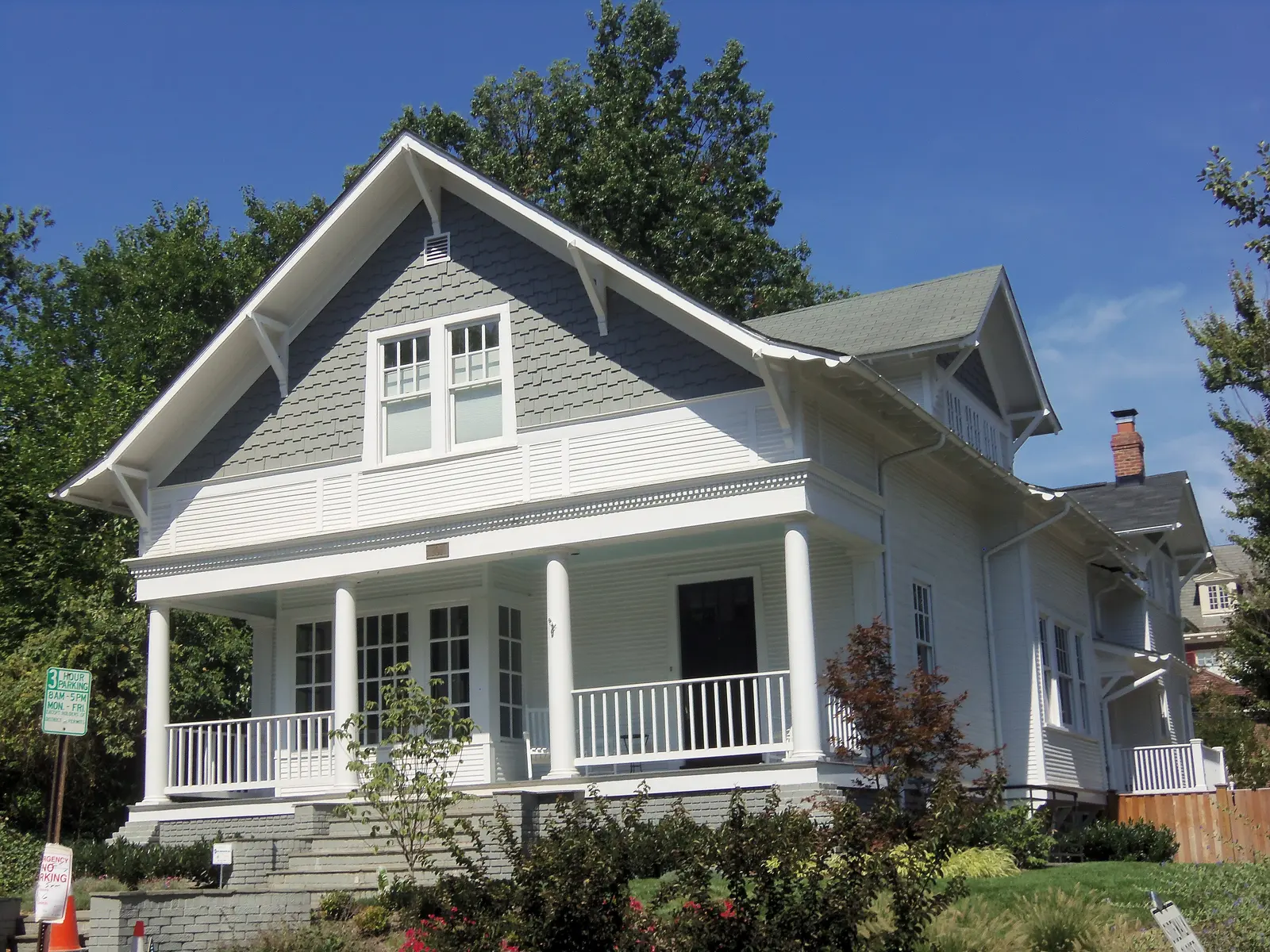
North Ridge/Rosemont, 1,118 acres between King Street and Glebe Road, is split between George Mason and Charles Barrett zones. Mostly ZIP 22302.
Last checked Oct. 19, 2026. The boundary is the City of Alexandria’s North Ridge/Rosemont plan area, from its Small Area Plans map layer and the North Ridge/Rosemont Small Area Plan (PDF). School zones come from Alexandria City Public Schools’ 2026-27 Attendance Zone Locator; ratings from the Virginia Department of Education’s School Quality Profiles; home values from the Zillow Home Value Index (Zillow Research); parks from the city’s parks map layer; associations from the city’s common ownership map; bus lines from DASH; place names, stores and road distances from OpenStreetMap (© OpenStreetMap contributors).
North Ridge and Rosemont make up the 1,118-acre plan area north of King Street, between Quaker Lane and Russell Road. Most of it is in ZIP code 22302. It holds two elementary schools, George Mason and Charles Barrett, and the zone line between them runs through the middle. OpenStreetMap names Beverley Hills, Braddock Heights, Jefferson Park, Monticello Park and Parkfairfax inside it.
What this means for you
- Zoned high school: Alexandria City High School (every city address)
- Typical home value, ZIP 22302: $422,471 in September 2026, according to Zillow
- Nearest interstate exit: I-395 Exit 6 (Shirlington), about 1.3 miles by road
- Zone questions: ACPS, 703-619-8000
Where it is
On the city’s map, King Street forms the southern edge, Russell Road the eastern edge, North Quaker Lane much of the western edge and West Glebe Road much of the northern edge. About a fifth of the outline is the city line with Arlington County, near Four Mile Run and Shirlington. Valley Drive, Martha Custis Drive, West Braddock Road, Cameron Mills Road, Old Dominion Boulevard, Gunston Road and Monticello Boulevard run through it.
Rosemont, next to King Street, straddles two plan areas. The city’s Potomac West plan calls the part east of Russell Road and south of Braddock Road “Lower Rosemont,” and that part is covered on our Del Ray page. The house in the photo above, in the Rosemont Historic District, is inside this plan area.
Schools
Under the 2026-27 ACPS boundaries, about 46% of the area is zoned for George Mason Elementary, 41% for Charles Barrett Elementary and 13%, on the east side, for Naomi L. Brooks. All of it is zoned for George Washington Middle.
| School | Grades | Address | State report card |
|---|---|---|---|
| George Mason Elementary | K-5 | 2601 Cameron Mills Road | School Quality Profile |
| Charles Barrett Elementary | PK-5 | 1115 Martha Custis Drive | School Quality Profile |
| Naomi L. Brooks Elementary | K-5 | 600 Russell Road | School Quality Profile |
| George Washington Middle | 6-8 | 1005 Mount Vernon Ave. | School Quality Profile |
| Alexandria City High | 9-12 | Every city address | School Quality Profile |
All five are Fully Accredited. In the state’s latest framework ratings, Naomi L. Brooks Meets Expectations (94.39); George Mason (83.91), Charles Barrett (84.37), George Washington Middle (85.92) and Alexandria City High (81.16) are Approaching Expectations. Check one address in the Attendance Zone Locator, and see our schools guide.
Home values
| ZIP code | Share of area | September 2026 | September 2025 | Change |
|---|---|---|---|---|
| 22302 | about 66% | $422,471 | $430,517 | down 1.9% |
| 22305 | about 23% | $805,548 | $783,494 | up 2.8% |
| 22301 | about 10% | $1,062,804 | $1,026,115 | up 3.6% |
The figures are Zillow’s Home Value Index, a modeled typical value for mid-priced homes, not a sale price. Each ZIP code is much larger than this plan area; 22302 also covers the Fairlington/Bradlee and Taylor Run areas. The citywide figure was $662,843 in September 2026, up 1.0%. See our home prices guide.
Parks and trails
- Monticello Park, 320 Beverley Drive, a natural area
- Robert Leider Park, 3002 Valley Drive, a natural area
- Beverley Park, 620 N. Overlook Drive
- Beach Park, 201 Rucker Place
- Woodbine Tot Lot, 1509 Woodbine St.
- School grounds the city’s map lists as shared parkland: George Mason, Charles Barrett and Maury
More in our parks and trails guide.
Getting around
Distances are measured on the road network from the middle of the plan area (OSRM routing on OpenStreetMap data); they are distances, not drive times.
| To | Distance |
|---|---|
| I-395 Exit 6 (Shirlington) | about 1.3 miles |
| I-395 Exit 7 (Glebe Road) | about 1.5 miles |
| City Hall, 301 King St. | about 2.9 miles |
| Reagan National Airport | about 3.7 miles |
King Street-Old Town Metrorail station is just beyond the southeast corner. Fare-free DASH buses, according to DASH’s schedules:
- Line 31: NVCC, King Street and King Street Metro to Braddock Road Metro
- Lines 36A and 36B: Mark Center, Shirlington and Glebe Road to Potomac Yard Metro
- Line 103 (weekdays): Braddock Metro, Russell Road and Glebe Road to Pentagon Metro
- Line 104 (weekdays): Braddock Metro, Cameron Mills Drive and Parkfairfax to Pentagon Metro
See our getting around guide.
Homeowners and civic associations
The city’s common ownership map lists six homeowners associations and two condominium associations in the plan area. The civic associations on the map are the North Ridge Citizens Association and the Beverley Hills Community Association; the Rosemont Citizens Association’s mapped area is in the Potomac West plan area next door. The city says associations last updated their own entries in 2015.
Groceries and everyday stores
OpenStreetMap lists no supermarket inside the plan area. The nearest, just west in the Fairlington/Bradlee plan area:
- Safeway, 3526 King St., and The Fresh Market, 3680 King St.
- CVS Pharmacy, 1521 N. Quaker Lane, and Walgreens, 3614 King St.
FoodStar, on West Glebe Road in Arlandria, is just to the northeast.
How to check an address
Look up the parcel on the city’s real estate search, then check the school on the Attendance Zone Locator, since the area is split between three elementary zones. Our property tax guide has the city rate, and our neighborhoods guide maps every plan area in the city.
Frequently asked questions
What elementary school serves North Ridge in Alexandria?
Under the 2026-27 ACPS boundaries, the North Ridge/Rosemont plan area is split: about 46% is zoned for George Mason Elementary, 41% for Charles Barrett Elementary and 13% for Naomi L. Brooks. All of it is zoned for George Washington Middle.
What ZIP code is North Ridge, Alexandria?
Mostly 22302, which covers about two-thirds of the plan area. The northeast part is in 22305 and the southeast part in 22301.
Is Parkfairfax in Alexandria or Arlington?
OpenStreetMap places Parkfairfax inside the City of Alexandria’s North Ridge/Rosemont plan area, near the Arlington County line.
What is the typical home value in North Ridge?
Zillow’s Home Value Index for ZIP 22302 was $422,471 in September 2026, down 1.9% from a year earlier. ZIP 22302 covers far more than North Ridge, and the figure is a modeled value, not a sale price.
Have your say